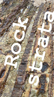
- 馬屎洲地質考察地點 http://www.arcgis.com/home/webmap/viewer.html?webmap=3a637c064fb34c9d8849459ba81cb4e7
- GEO PARK LEAFLET https://www.geopark.gov.hk/eleaflet/pdf/07-E-leaflet-Ma-Shi-Chau.pdf
- HKU https://web.hku.hk/~chanls/Teaching_Resources/fieldTripGuides/ma%20sze%20chau%20_EDB.pdf
- HONG KONG GEOLOGICAL HISTORY https://www.edb.gov.hk/attachment/en/curriculum-development/kla/pshe/references-and-resources/geography/VolcanicGeology.pdf
The Geological Stratigraphy in the Northwestern Ma Shi Chau Hardcover – 26 January 2017
This dissertation, "The Geological Stratigraphy in the Northwestern Ma Shi Chau" by Shing-cheong, Francis, Law, 羅承昌, was obtained from The University of Hong Kong (Pokfulam, Hong Kong) and is being sold pursuant to Creative Commons: Attribution 3.0 Hong Kong License. The content of this dissertation has not been altered in any way. We have altered the formatting in order to facilitate the ease of printing and reading of the dissertation. All rights not granted by the above license are retained by the author.
Abstract:
Before the year 2000, the sedimentary and volcano-sedimentary rocks on Ma Shi Chau (MSC) have long been regarded as the formations in Permian and Jurassic respectively. Geotechnical Engineering Office (GEO) had modified the geological model and changed the Northeastern side of MSC, the pre-volcanic sedimentary rocks, to an older rock formation, from Permian Tolo Harbour Formation to Devonian Bluff Head Formation. The reasons of change are mainly from structural evidence and lithological evidence.Subjects:
Geology, Stratigraphic
Geology - China - Hong Kong
AFCD
地質公園土地利用的爭議


沒有留言:
張貼留言